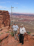
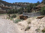
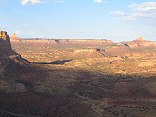
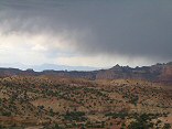
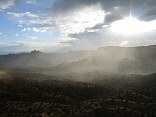
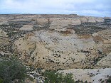
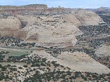
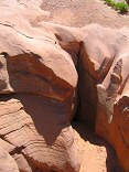
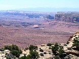
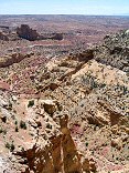
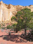
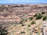
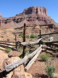
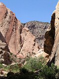
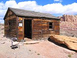
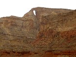
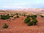
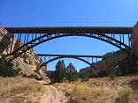
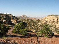
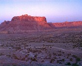
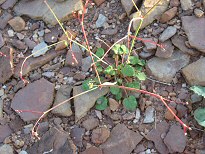
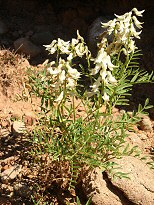
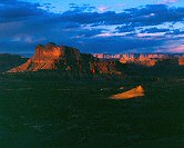
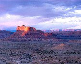
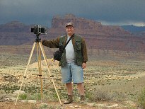
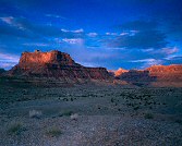
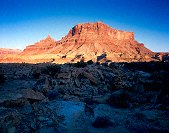
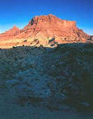
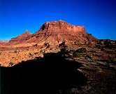
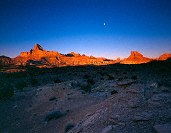
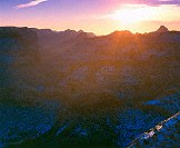
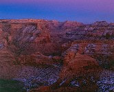
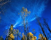
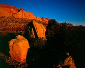
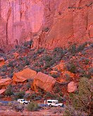
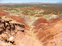
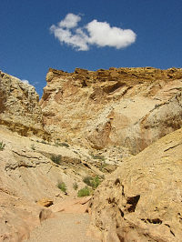
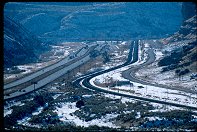
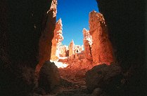
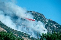
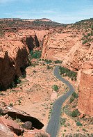
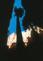
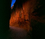
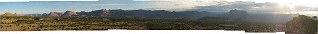
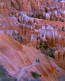
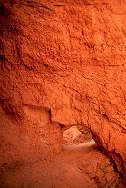
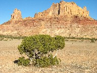
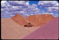
KA7OEI and K7HFV at the Panorama Point receive site
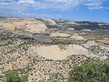
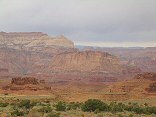
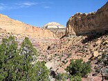
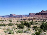
Glen Canyon Rec Area

Query = 'can'
Note that private photos will not be listed below unless you have logged in.
Results from the Directory listing:
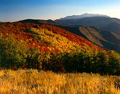
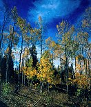
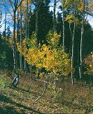
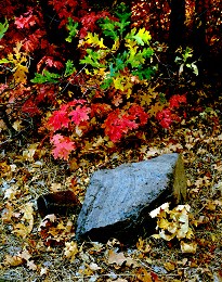
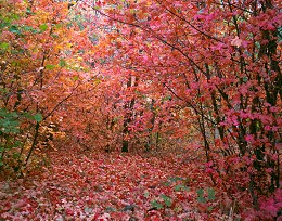
| 2008/10-02 | Shots with my new Canon G9, fall foliage over the Nebo Scenic Loop, central Utah | |
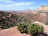
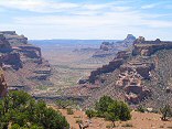
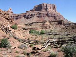
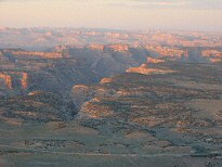
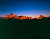
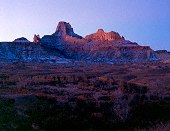
| 2005/July20 | A few shots at Panorama Point (Glen Canyon), and at the rock crawling area, south end of Lake Mountain. | |
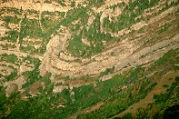
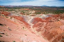
| 2004/Mar28 | San Rafael digital shots, including Behind the Reef road and Reds Canyon. | |
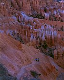
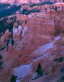
| 2003/Jul02 | Cleaning out the LF film box: fall on Mt. Nebo, winter in Bryce Canyon, San Rafael Swell in winter and spring, Strawberry Peak in summer. | |
| 2003/Mar31 | The San Rafael River valley, Mexican Mountain, San Rafael Swell. Digital. | |
| 2002/Nov03 | Long Canyon, Circle Cliffs, Capitol Reef, along the Burr Trail (LF) | |
| 2002/Jul08 | Medium format film scans (B&W and E6) from over the years. | |
| 2002/Jun19 | Waterpocket Fold, Burr Trail, Bryce Canyon, Alpine Loop Scenic Road | |
| 2002/Jun14 | Digital Travelog: Grand Staircase-Escalante Monument, Utah Highway 12, Bryce Canyon | |
| 2002/Jun06 | Climbers at Fisher Towers, LF & 35mm shots around Bryce Canyon NP. Around Utah S-12, Devil's Garden, Long Canyon, Boulder Mountain, Spanish Fork. | |
| 2002/May29 | Digital shots at Bryce Canyon NP, Devils Garden (Grand Staircase-Escalante Monument), and Long Canyon (Burr Trail) | |
| 2002/May11 | Digital shots: Cisco Utah, Goblin Valley State Park, San Rafael Swell, Bryce Canyon National Park, Capitol Reef National Park, Fisher Towers | |
| 2002/May06 | LF: Mt. Nebo in its various moods, and Fisher Towers, Arches, Little Wild Horse Canyon slots canyon shots | |
| 2002/Apr01 | Large-format shots from Fisher Towers and a few of Mt. Nebo (some shots underexposed, so they scanned oddly). | |
| 2001/Oct03 | Large-format scans taken over the last year, many fall 2001 pictures. | |
| 2001/Sep08 | Climbers in Rock Canyon at sunset. | |
| 2001/Jul14 | Climbers in Rock Canyon |
Results from the Photographs listing:
|
|
#img_0425
KA7OEI and K7HFV at the Panorama Point receive site Glen Canyon Rec Area |
 |
#img_9192
Eagle Canyon, near I70 |
 |
#img_9150
Head of Poor Canyon |
 |
#img_9145
Stone formation, head of Poor Canyon The Dike |
 |
#img_9127
Gate, Cat Canyon |
 |
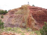
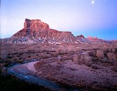
#479-1
Reds Canyon, Hondoo Country Link Flat overlook between Sulfur Canyon & Lucky Strike, lower ledge |
 |
#479-2
Reds Canyon, Hondoo Country Link Flat overlook between Sulfur Canyon & Lucky Strike, lower ledge |
 |
#479-4
Reds Canyon, Hondoo Country Link Flat overlook between Sulfur Canyon & Lucky Strike, lower ledge |
 |
#img_9044
Upper Reds Canyon, Family Butte to the right |
 |
#img_8967
Tomsich Butte, against the magnificant walls above Hondo Country |
 |
#img_8938
Mine in a canyon south of the Lucky Strike |
 |
#img_8934
Miniature canyonscape on the Reds Canyon road |
 |
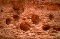
#img_8917
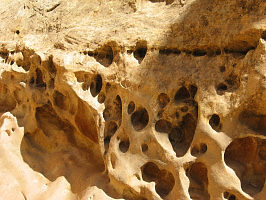
Swiss Cheese in Sulfur Canyon |
 |
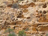
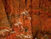
#img_8915
Multicolored Chinle formations, Sulfur Canyon |
 |
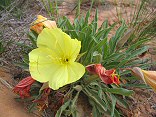
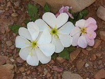
#img_8901
Primrose Reds Canyon |
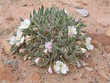 |
#img_8878
Primrose Reds Canyon wash |
 |
#img_8875
Primrose Reds Canyon, near the wash bed |
 |
#img_8873
Primrose Reds Canyon, near the wash bed |
 |
#483-2
Reds Canyon, sunset 1/2 inch rise, 20 deg tiltback Head of Reds Canyon |
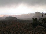 |
#img_8809
Storms hit Reds Canyon |
 |
#img_8771
More rainstorms coming up Reds Canyon |
 |
#img_8770
A spring vent, head of Reds Canyon |
 |
#img_8768
A spring at the head of Reds Canyon |
 |
#img_8767
A view towards the head of Reds Canyon |
 |
#img_8764
Reds Canyon |
 |
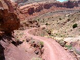
#img_8607
A jeep trail in the foreground, and a single-track dropping into the canyon east of Flat Top. |
 |
#img_8598
Sqaure Top, Reds Canyon |
 |
#img_8594
Square Top in Reds Canyon |
 |
#img_8569
Rain in Reds Canyon |
 |
#img_8565
A rainstorm moved north through Reds Canyon |
 |
#img_8562
Reds Canyon from Green Vein Mesa |
 |
#img_8516
San Rafael Knob at the head of Reds Canyon |
 |
#img_8482
Eagle Canyon |
 |
#img_8481
Eagle Canyon |
 |
#img_8480
Eagle Canyon |
 |
#img_8479
Eagle Canyon |
 |
#img_8478
Eagle Canyon |
 |
#img_8474
Eagle Canyon I-70 @ Moore Road exit |
 |
#img_8405
Looking down Ramp Canyon |
 |
#img_8404
Sandstone erosion (Wingate?) in Ramp canyon |
 |
#img_8402
Looking down Ramp Canyon |
 |
#img_8401
Behind the Reef road descends in to Ramp canyon |
 |
#img_8398
Cistern Canyon climbs up threough the red Moenkopi to the yellow kaibab limestone to the white Coconino sandstone |
 |
#img_8395
The Behind the Reef road climbs the Kayenta ledge high above the red Moenkopi ledges of the Cistern Canyon |
 |
#img_8393
Moenkopi valley of Cistern Canyon |
 |
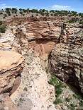
#img_8387
Small Dryfall, Little Wild Horse Canyon |
 |
#img_8385
Navajo hoodoos in Little Wild Horse Canyon, near the Behind the Reef Road |
 |
#img_8380
Plateau above the head of Reds Canyon |
 |
#img_8372
Reds Canyon and Hondu Country, from above the Lucky Strike Mine |
 |
#img_8367
Looking south down reds Canyon from the edge of Link Flats |
 |
#img_8366
The ledgy turmoil of Reds Canyon |
 |
#img_8365
Looking north into Reds Canyon, Family Butte to the left background |
 |
#img_8355
Looking down into Sulphur Canyon, a tributary of Reds Canyon |
 |
#img_8354
Looking down into Sulphur Canyon, a tributary of Reds Canyon |
 |
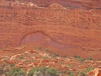
#img_8353
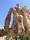
Eagle Canyon Arch |
 |
#img_8352
San Rafael Knob and the head of Red Canyon |
 |
#img_8345
Reds canyon, from the head near San Rafael Knob |
 |
#img_8344
Cirque near the head of Reds Canyon |
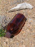 |
#img_8333
I found a worker campsite atop Green Vein Mesa. This was a syrup bottle, sith a little syrup still inside. Also in the area: baby bottles, coffee cans, children's toys. |
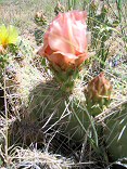 |
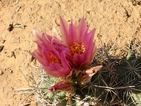
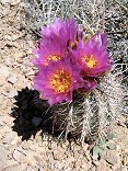
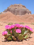
#img_8303
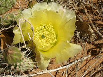
Prickly Pear Cactus Opuntia polyacantha |
 |
#img_8302
Prickly Pear Cactus Opuntia polyacantha |
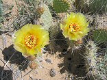 |
#img_8301
Prickly Pear Cactus Opuntia polyacantha |
 |
#img_8296
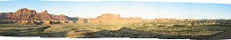
Mexican Mountain and the interior of the Reef |
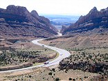 |
#img_8294
I-70 snakes down into Spotted Wolf Canyon |
 |
#img_8293
A cow-trail-covered slope of Cow Canyon |
 |
#img_8292
Upper reach of Cow Canyon |
 |
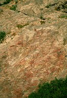
#img_8276
Near the center: the Buckhorn Wash pictographic panel, shot from the North shoulder of Calf Canyon |
 |
#img_8275
The interior of the northen Swell form the north shoulder of Cow Canyon |
 |
#img_8267
Upper reach of one of the upper eastern canyons of Buckhorn Wash |
 |
#img_8265
Upper reach of one of the upper eastern canyons of Buckhorn Wash |
 |
#img_8248
The old corral just North of Mexican Mountain. |
 |
#img_8247
The old corral just North of Mexican Mountain. |
 |
#img_8216
Cliffs above Mexican Mountain Road Near the Bridge campground |
 |
#img_8197
The bulk of the Swell that appears to be a point at Greasewood Canyon, as seen from the south of the Squeeze Note the size of the Reef (formed by the Grand Canyon Group) relative to the interior of the Swell, made of the Perminan Group), a difference of 1700 feet |
 |
#img_8193
Uneva Mine Canyon |
 |
#img_8192
Uneva Mine Canyon |
 |
#img_8187
Looking down out of Uneva Mine Canyon |
 |
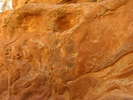
#img_8186
Swiss Cheese in Uneva Mine canyon |
 |
#img_8184
Farther up the Uneva Mine canyon. Wingate sandstone on the walls, and Coconino sandstone making up the bulge of the Swell in the center. |
 |
#img_8183
The Uneva Mine Canyon, second canyon south of I-70. Note the Navajo and Wingate formations, and in back, the Coconino sandstone, same formation that makes the Black Box. |
 |
#img_8180
The Grand Canyon Group on end: Carmel, Navajo, Kayenta, Wingate formations. |
 |
#img_8176
I-70 starts up Spotted Wolfe Canyon through the Reef. |
 |
#img_8138
Sunset looking up the little grand canyon of the San Rafael River |
 |
#img_8096
Cistern Canyon drainage (Moenkopi formation) Behind the Reef road San Rafael Swell |
 |
#img_8095
Cistern Canyon drainage (Moenkopi formation) Behind the Reef road San Rafael Swell |
 |
#img_8094
Cistern Canyon drainage (Moenkopi formation) Behind the Reef road San Rafael Swell |
 |
#img_8093
Cistern Canyon drainage (Moenkopi formation) Behind the Reef road San Rafael Swell |
 |
#img_8092
Slot Canyon swiss cheese, Cistern Canyon Behind the Reef road San Rafael Swell |
 |
#img_8091
One of the small problems one encounters on the ATV trail Cistern Canyon bottom, Behind the Reef road San Rafael Swell |
 |
#img_8089
Cistern Canyon enters the Reef Behind the Reef road San Rafael Swell |
 |
#img_8088
Cistern Canyon drainage (Moenkopi formation) Behind the Reef road San Rafael Swell |
 |
#img_8086
Cistern Mine, South of Bell Canyon Behind the Reef road San Rafael Swell |
 |
#img_8080
Chute Canyon exits the Reef Behind the Reef road San Rafael Swell |
 |
#img_8079
Inside the San Rafael Reef, at Crack and Chute Canyons Behind the Reef road San Rafael Swell |
 |
#img_8078
Inside the San Rafael Reef, at Crack and Chute Canyons Behind the Reef road San Rafael Swell |
 |
#img_8051
Hondu Arch Reds Canyon, Tomish Butte San Rafael Swell |
 |
#img_8047
Hondu Country: North Butte(?, just north of Tomish Butte) and Hondo Arch Reds Canyon San Rafael Swell |
 |
#img_8045
One of the main shafts, Lucky Strike Mine Reds Canyon San Rafael Swell |
 |
#img_8044
Worker pegboard, Lucky Strike Mine Reds Canyon San Rafael Swell |
 |
#img_8043
Scenic view down Reds Canyon Just north of Family Butte San Rafael Swell |
 |
#img_8041
Scenic view down Reds Canyon Just north of Family Butte San Rafael Swell |
 |
#img_8039
Scenic view down Reds Canyon Just north of Family Butte San Rafael Swell |
 |
#img_8033
Green Vein Mesa mine? North end of Reds Canyon San Rafael Swell |
 |
#img_8032
Green Vein Mesa mine? North end of Reds Canyon San Rafael Swell |
 |
#img_8031
Green Vein Mesa mine? North end of Reds Canyon San Rafael Swell |
 |
#img_8030
Unnamed pinnacle north of Family Butte North end of Reds Canyon San Rafael Swell |
 |
#img_7972
Cliffs above Mexican Mountain Road Lockhart Box San Rafael Swell |
 |
#img_7967
Small U-canyon wash Lockhart Box San Rafael Swell |
 |
#img_7966
Small U-canyon wash Lockhart Box San Rafael Swell |
 |
#img_7963
Small U-canyon wash Lockhart Box San Rafael Swell |
 |
#img_7716
The bridges over Eagle Canyon, I-70 |
 |
#img_7532
Mexican Seep |
 |
#470-3
Sage, hillside, Spanish Fork peak, midground maple=orange far end of Wadsworth Peak trail Right Fork of Hobble Creek Canyon |
 |
#467-2
Meadow, brook tilt down, lens tilted back also. between f/32 and f/45. Main Canyon rd |
 |
#img_5241
Devils Hole Above Mexican Mountian road |
 |
#img_5224
Cow canyon, and Calf canyon (foreground) |
 |
#457-1
Cow & calf canyons, srswell Photo outcrop, Cedar mt, near brown bldg |
 |
#img_5121
Sclerocactus parviflorus Mexican Mountain Road |
 |
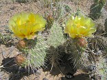
#img_5120
Prickly Pear Cactus Mexican Mountain Road |
 |
#img_5067
End of the trail, White Horse Canyon, below the road |
 |
#img_5064
White Horse Canyon, below the road |
 |
#img_5055
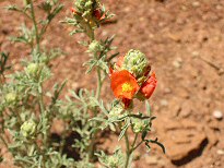
Desert Globemallow Mexican Mountain Road |
 |
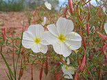
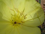
#img_5052
Evening Primrose, fully open Oenothera caespitosa? Mexican Mountain Road |
 |
#img_5037
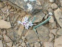
Wild Onion Allium Mexican Mountain Road |
 |
#img_5034
Cryptantha Mexican Mountain Road |
 |
#458-2
mexican mt slope just above second gate on mexican mt rd |
 |
#458-3
mexican mt slope just above second gate on mexican mt rd |
 |
#459-4
the reef, west side slope just above second gate on mexican mt rd |
 |
#459-3
mexican mt and the cliffs this location is very good for sun angle! slope just above second gate on mexican mt rd |
 |
#456-2
lone peak, cliffs north of mexican mt slope just above second gate on mexican mt rd |
 |
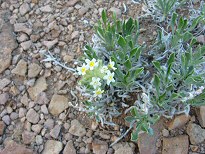
#img_4996
Desert Trumpet. The tall-standing stalk stays until trampled, leaving the desert scattered with veritcal pods with "feelers" Mexican Mountain Road |
 |
#img_4995
Eaton's Penstemon Penstemon eatonii Mexican Mountain |
 |
#img_4966
Milkvetch Astragalus Mexican Mountain Road |
 |
#img_4951
Buckwheat Eeiogonum Mexican Mountain Road |
 |
#img_4948
Milkvetch Astragalus Mexican Mountain Road |
 |
#img_4943
Pallid milkweed Ascepias cryptoceras Mexican Mountain Road |
 |
#img_4942
Yellow Cryptantha Mexican Mountain Road |
 |
#img_4929
Crescent Milkvetch Mexican Mountain Road |
 |
#461-3
mexican mt metered 10 sec. jackass bench, northernmost point |
 |
#457-4
reef tooth, between river exit and black dragon canyons jackass bench, northernmost point |
 |
#460-1
mexican mt jackass bench, northernmost point |
 |
#img_4877
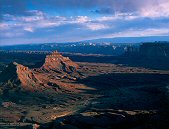
Mexican Mountain |
 |
#456-3
mexican mountain <i>full rise</i> West Jackass benches south of mex mt (above Swasey's leap turnoff) |
 |
#464-4
Cliffs along mexican mountain rd fule rise West Jackass benches south of mex mt (above Swasey's leap turnoff) |
 |
#464-3
Mexican mountain West Jackass benches south of mex mt (above Swasey's leap turnoff) |
 |
#img_4768
Rain along the Mexican Mountain road |
 |
#459-2
clearing storm, san rafael river exit canyon deep, rolling thunder from Book cliffs. I70 audible. South Jackass benches south of mex mt |
 |
#img_4752
Bruce Wilson self portrait, in front of Mexican Mountain Jackass Benches |
 |
#462-4
Mexican mt & locale Jackass benches south of mex mt |
 |
#465-2
Mexican mt & locale Jackass benches south of mex mt |
 |
#img_4687
Mexican Mountain Jackass Benches |
 |
#img_4677
The cliffs east of Mexican Mountain Road Jackass Benches |
 |
#img_4661
The canyons of th enorthern San Rafael. Window Blind Peak is prominent. |
 |
#462-3
mexican mt above Swazy's Leap, looking east |
 |
#img_4584
Mexican Mountain Jackass Benches, San Rafael Swell |
 |
#462-1
Mexican mt some tilt up West side, above Swazy's Leap |
 |
#450-3
Goodwater canyon, looking North. Time uncertain. Entered when slide developed. Original entry lost? Main sideroad to East side of Goodwater cyn. |
 |
#450-2
mexican mt dull glow remains mex mt foot trail |
 |
#449-4
mexican mt last sunlight mex mt foot trail |
 |
#449-2
mexican mt mex mt foot trail |
 |
#448-3
mexican mt mex mt foot trail |
 |
#448-2
mexican mt mex mt foot trail |
 |
#448-1
mexican mountain, san rafael reef (west side) second gate, mex. mt. rd., on cliff. |
 |
#455-2
Arches section, gobblet-shaped, cup-shaped, sugar-bowl-shaped arches overcast, facing sun Losee Canyon, Arches trail loop |
 |
#439-2
small pinion pine overcast, facing sun Losee canyon, Arches trail loop, above the wooden stairs, top of ridge |
 |
#439-4
pink cliffs detail Losee canyon, Arches trail loop, near the wooden stairs |
 |
#453-4
silent city, whole canyon diffuse light on the scene, camera facing north metered 2 sec inspiration pt |
 |
#445-4
San Rafael Valley, looking towards the Wedge Overlook some fwd tilt Mexican mountain rd |
 |
#447-2
San Rafael Valley, looking towards the Wedge Overlook some fwd tilt Mexican mountain rd |
 |
#446-1
Assembly Hall Peak, San Rafael River in foreground metered 30, shot 45 sec Mexican Mountain rd |
 |
#446-4
Peaks behind (southeast) of windowblind metered 60 sec, shot 90 window blind peak? mexican mt rd |
 |
#442-4
Little Grand Canyon canyon haze = 5 Wedge overlook, east side |
 |
#443-1
Little Grand Canyon clouds at 5, before sunrise Wedge overlook, west side |
 |
#443-2
Little Grand Canyon cliffs at 5, before sunrise xp 5 sec. goofed, forgot filter factor Wedge overlook, west side |
 |
#442-2
Little Grand Canyon cliffs at 5, after sunset xp 5 sec. Wedge overlook, east side |
 |
#441-4
Little Grand Canyon cliffs at 5.5, just after sunset 1.5 sec. Wedge overlook, east side |
 |
#441-1
Little Grand Canyon cliffs at 5.5 Wedge overlook, east side |
 |
#428-3
Peteetneet Creek Nebo loop rd, Payson canyon |
 |
#428-2
Falls (double set) Payson canyon, Peteneet cr |
 |
#424-4
Provo river, yellow trees Canyon Glen park |
 |
#401-2
Aspen, clouds Full rise, gathered bellows Nebo loop, payson canyon, Shram trail |
 |
#410-1
Side canyon, from hill Full possible rise Long Canyon, Burr Trail |
 |
#410-2
Side canyon, green maple Long Canyon, Burr Trail |
 |
#408-3
Circle cliffs Tilted down a bit. End of Long Canyon, Burr trail, on boulder |
 |
#411-1
Circle cliffs w/boulders full sun, too much contrast End of Long Canyon, Burr trail, on boulder |
 |
#406-4
Circle cliffs w/boulders Shot 5 sec. End of Long Canyon, Burr trail, on boulder |
 |
#406-3
Circle cliffs w/boulders 20 sec metered, shot 26 sec. End of Long Canyon, Burr trail, on boulder |
 |
#407-4
Dry narrows (CNYN), pool at end Metered at 20 sec, shot 45 sec. Canyon faces SE Long Canyon, Burr Trail |
 |
#408-1
Dry narrows (CNYN) Metered at 6 sec, shot 12 sec. Long Canyon, Burr Trail |
 |
#411-3
Crack in wall, full height Long Canyon, Burr Trail |
 |
#411-4
Crack in wall Long Canyon, Burr Trail |
 |
#407-3
Tree on ledge Long Canyon, Burr Trail |
 |
#408-2
Dykinga et all Long Canyon, Burr Trail |
 |
#408-4
Cut-out wall Long Canyon, Burr Trail |
 |
#407-1
Juniper, big rocks, wall Long Canyon, Burr Trail |
 |
#407-2
Water-worn rock, dead, tall weed Long Canyon, Burr Trail |
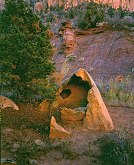 |
#410-3
Hollowed-out rock Long Canyon, Burr Trail |
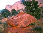 |
#409-1
Big orange rock Long Canyon, Burr Trail |
 |
#410-4
Bigl drainage, Juniper, rock with holes Long Canyon, Burr Trail |
 |
#409-3
Bigl drainage, bush, hoodoo Long Canyon, Burr Trail |
 |
#398-3
Aspen grove (new) 0.5mi down Bear Canyon trail |
 |
#398-4
Aspen grove (new) 0.5mi down Bear Canyon trail |
 |
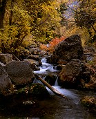
#376-3
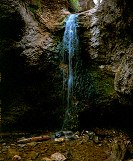
Grotto falls Payson canyon Payson Canyon |
 |
#376-2
stream, foliage maple bench Payson Canyon |
 |
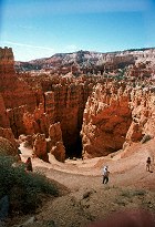
#129-2948
The Southern set of switchbacks Bryce Canyon National Park, Navajo Loop |
 |
#129-2945
The upper overlook, Inspiration Point Bryce Canyon National Park |
 |
#129-2942
Switchbacks, Navajo Loop Bryce Canyon National Park |
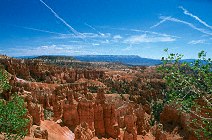
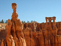 |
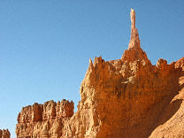
#129-2940
Thor's Hammer, Temple of Osiris Bryce Canyon National Park, Navajo Loop |
 |
#129-2937
The Sentinel Bryce Canyon National Park, Navajo Loop |
 |
#128-2862
Morinings were windless, so smoke form the fire settled into the Canyons. The lights of Tropic Utah are just visible |
 |
#127-2793
What follows are a lot more digital shots at Bryce Canyon National Park |
 |
#127-2733
The entrance to Peek-a-Boo slot canyon Dry Fork of the Coyote Grand Staircase-Escalante Monument |
 |
#126-2648
Long Canyon overlook, Burr trail |
 |
#124-2428
Long Canyon Homestead Viewpoint, Highway 12, Boulder Mountain |
 |
#124-2422
Wall, swiss cheese holes carved by the stream Long Canyon Burr Trail Utah |
 |
#124-2419
Rock Cove Long Canyon Burr Trail Utah |
 |
#123-2393
Yovimpa Point Bryce Canyon National Park Utah |
 |
#123-2388
Twilight, Silent City Bryce Canyon National Park Utah |
 |
#123-2356
Bristlecone Point, with Powell Point (south end of the Aquarius Plateau) in the background Bryce Point Bryce Canyon National Park Utah |
 |
#123-2309
Rainbow Point Bryce Canyon National Park Utah |
 |
#122-2288
Switchbacks on the right side of the Navaho Loop Sunset Point Bryce Canyon National Park Utah |
 |
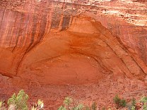
#122-2247
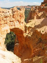
Natrual Bridge (really an arch) Natrual Bridge Viewpoint Bryce Canyon National Park Utah |
 |
#118-1895_img
The white band is ash fromt he eruption of Mt. Boulder, 50 million years ago Bryce Canyon National Park |
 |
#118-1884_img
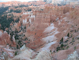
Afternoon glow in the Silent City Bryce Canyon National Park |
 |
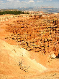
#118-1864_img
Silent City Bryce Canyon National Park |
 |
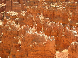
#118-1857_img
Silent City Bryce Canyon National Park |
 |
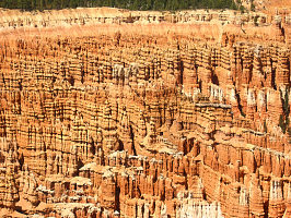
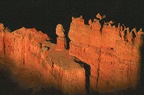
#118-1855_img
Hoodoos in the Silent City Bryce Canyon National Park |
 |
#117-1783_img
Help identify this snake! Little Wild Horse Canyon |
 |
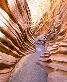
#117-1782_img
Little Wild Horse Canyon |
 |
#117-1781_img
Little Wild Horse Canyon |
 |
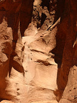
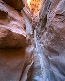
#117-1780_img
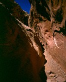
Sandstone walls, slot canyon Little Wild Horse Canyon Utah |
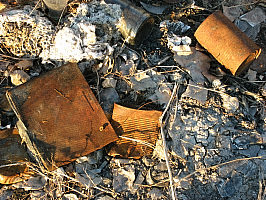 |
#113-1364_img
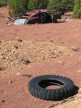
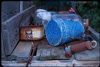
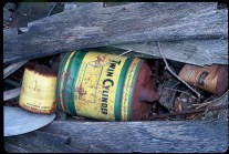
More garbage. |
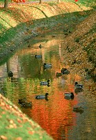 |
#271-33
Ducks, in BYU's canal, by the bell tower |
 |
#2262
Ridgeline trees Nephi Canyon, Mt. Nebo scenic loop |
 |
#2256
Small stream (originating form a spring) Maple Bench campground Payson Canyon UT |
 |
#239-1
Cascades on the Santaquine River Santaquine Canyon Above Santaquin Utah |
 |
#214-4
Can and rock, light rain. Near Maple Bench campground, payson canyon. |
 |
#249-1
The Grotto Payson Canyon (Mt. Nebo Loop) Utah |
 |
#249-3
Peteeneet School, Statue Payson Utah |
 |
#250-3
Water basin, The Grotto falls Payson Canyon (Mt. Nebo Loop) Utah |
 |
#245-2
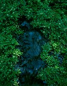
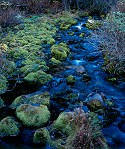
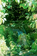
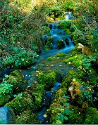
Small creek with moss Alpine loop (top of American Fork Canyon) Utah |
 |
#240-3
Small cascade on Santaquine River Santaquine Canyon Utah |
 |
#2274
Small stream & falls American Fork Canyon UT |
 |
#060-19
|
 |
#239-25
Echo Canyon I80 Utah |
 |
#239-32
Echo Canyon, Utah |
 |
#1738
Ophir canyon vegetation |
 |
#1752
Echo Canyon, Utah |
 |
#350-25
Looking up toward the switchbacks (all 28 of them), Wall Street Bryce Canyon National Park, Navajo Loop |
 |
#1708
Mine tailings in Sunshine Canyon, Utah. These were left by the Sunshine mine near 1900. |
 |
#1690
The mouth of Echo Canyon, Utah |
 |
#1699
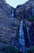
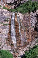
Bridal Veil Falls Provo Canyon Utah |
 |
#1720
A unique effect. If you look closely, you can see the shadow of the contrail. This happens only when the contrail, the sun, and you are in the proper alignment. |
 |
#241-30
Bridal Veil Falls Provo Canyon Provo UT |
 |
#241-35
Snow and ice over a tributary of the Provo River, Provo Canyon, Utah. |
 |
#2099
See that fighter on the ground? He defeated Jarl Thjothrekr, who had this significant advantage. |
 |
#060-18
Oil can |
 |
#214-2
Fall grove. Maple Bench campground Payson canyon Utah |
 |
#2180
From left to right, Lord Duncan Douglas MacPherson, Lord Michael Nymandus, Lord Mikail Azadan Askoldovich -- all from Lonely Tower. |
 |
#a108-23
Along the Alpine Loop Scenic Highway, between Sundance Ski Resort and American Fork Canyon. |
 |
#a110-27
Bridal Veil Falls Provo Canyon UT |
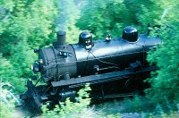 |
#v116-19
The "Heeber Creeper", Heber Valley RailRoad Engine No. 618, a coal-fired 2-8-4. Provo Canyon Utah |
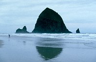 |
#162v-02
Haystack Rock Cannon Beach Oregon |
 |
#163v-16
climber, just topped out Rock Canyon Provoq UT |
 |
#164m-05
Forest Service plane dropping retardant on the Slate Canyon fire, August 2001. |
 |
#168v-36
Landscape Top of Alpine Scenic Drive Provo canyon/American Fork canyon UT |
 |
#171v-35
Rock fold, Mouth of Provo Canyon. |
 |
#210-4
Small rivulet in American Fork Canyon |
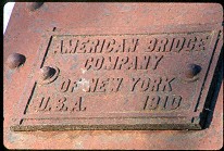 |
#209-21
American Bridge Company of New York, U.S.A., 1910 DM&E bridge, East of Volga SD |
 |
#355-24
Long Canyon Burr Trail |
 |
#350-03
Wall Street Bryce Canyon National Park, Navajo Loop |
 |
#350-17
Owl Rock, near the Navajo/Peekaboo junction Bryce Canyon National Park, Navajo Loop |
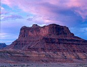
 |
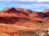
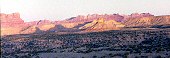
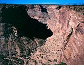
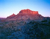
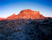
#mexicanmountain2
|
 |
#350-28
Contrails over the pink cliffs Bryce Canyon National Park |
 |
#350-29
Navajo loop switchbacks Bryce Canyon National Park |
 |
#350-30
What follows are many shots at the Bryce overlooks along the road up from Rainbow Point Bryce Canyon National Park |
 |
#354-28
"Swiss Cheese", Long Canyon Burr Trail |
 |
#350-07
Old Douglas fir tree at the Eastern end of Wall Street Bryce Canyon National Park, Navajo Loop |
 |
#355-20
Streambed, Long Canyon Burr Trail |
 |
#349-07
Hikers on the Peekaboo loop trail, Bryce Point Bryce Canyon National Park |
 |
#127-2780
Panorama along the trail leading down to the Dry Fork of the Coyote (below are the Narrows, and three slot canyons) |
 |
#357-1
Long Canyon overlook, North end of Long Canyon, toward the Circle Cliffs and Capitol Reef |
 |
#358-3
Narrows, Dry Fork, Coyote Canyon Hole-In-The-Rock road |
 |
#359-4
Smoke fro the Sevier Mountain fire Bryce Canyon National Park |
 |
#239-33
Cliffs above the mouth of Echo Canyon, Utah |
 |
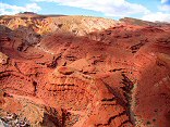
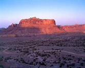
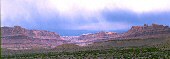
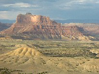
#mexicanmountain
|
 |
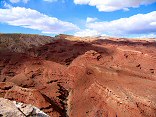
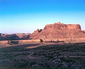
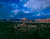
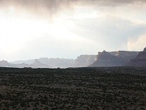
#mexicanmountain4
|
 |
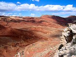
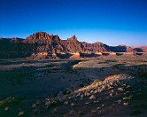
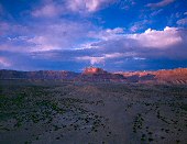
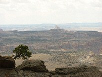
#mexicanmountain3
|
 |
#355-08
Long Canyon overlook, North end of Long Canyon, toward the Circle Cliffs and the Henry Mountains |
 |
#325-1
Hikers, as shot Bryce Canyon National Park |
 |
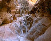
#311-1
Little Wild Horse slot canyon Near Goblin Valley State park, San Rafeal Swell Utah |
 |
#311-2
Little Wild Horse slot canyon Near Goblin Valley State park, San Rafeal Swell Utah |
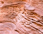 |
#320-1
Pocketted sandstone wall Little Wild Horse Canyon |
 |
#320-2
Little Wild Horse Canyon |
 |
#320-3
Little Wild Horse Canyon |
 |
#321-2
Pocketted sandstone wall Little Wild Horse Canyon |
 |
#321-3
Serpentine Little Wild Horse Canyon |
 |
#321-4
Daylight Little Wild Horse Canyon |
 |
#350-02
Down in the canyon, on Navaho Loop trail. Bryce Canyon National Park |
 |
#325-1a
Hikers, colors fixed with autolevels in Pshotoshop Elements Bryce Canyon National Park |
 |
#349-19
Late afternoon Bryce Canyon National Park |
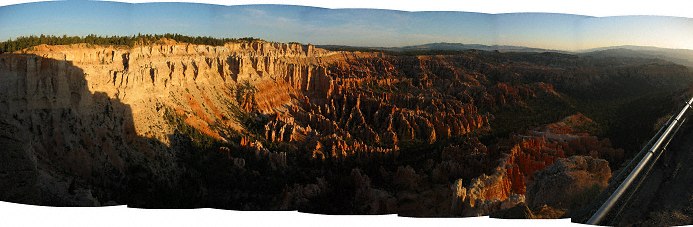 |
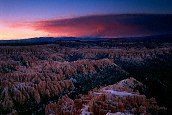
#122-2
Sunrise Panorama Bryce Point Bryce Canyon National Park Utah |
 |
#337-30
Shot from Bryce Point Bryce Canyon National Park |
 |
#338-1
Sunrise, Bryce Point Bryce Canyon National Park |
 |
#341-2
Sunset, Bryce Point Bryce Canyon National Park |
 |
#345-2
Silent City Bryce Canyon National Park |
 |
#348-14
Morning light, Bryce Point Bryce Canyon National Park |
 |
#348-30
Small tunnel, Navajo Loop trail Bryce Canyon National Park |
 |
#298-3
Aspen trunks Box Canyon Manti Utah |
 |
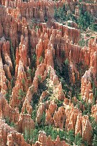
#324-3
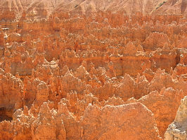
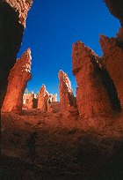
Hoodoos Bryce Canyon National Park |
Results from the Comments:
|
|
Donald 187
thought on 5/30/2006 that this photo was displayed properly
and added the following: |
 |
Lisa Jensen
thought on 8/8/2005 that this photo was very cool
and added the following: |
 |
Jake Richens
of Salt Lake
thought on 6/23/2005 that this photo was superb
and added the following: |
 |
Bruce Wilson
of Provo, Utah
thought on 1/9/2005 that this photo was displayed properly
and added the following: |
 |
Your Uncle George
of Miami
thought on 12/27/2004 that this photo was superb
and added the following: |
 |
Dorde Woodruff
of SLC
thought on 5/30/2004 that this photo was good
and added the following: |
 |
Dorde Woodruff
of SLC
thought on 5/30/2004 that this photo was displayed properly
and added the following: |
|
|
Cemal Ekin
of Rhode Island
thought on 11/24/2002 that this photo was displayed properly
and added the following: |
 |
An anonymous visitor
thought on 11/5/2001 that this photo was superb
and added the following: |
Private photo not shown. |
Please login on the Catalog page to view comments on private photos. |
 |
Bruce Wilson
thought on 4/19/2001 that this photo was 'interesting'
and added the following: |
 |
Bruce Wilson
thought on 4/5/2001 that this photo was okay
and added the following: |
 |
Bruce Wilson
of Brookings SD
thought on 4/5/2001 that this photo was superb
and added the following: |
Results from the old catalog:
This search is a simple search for a word that appears somewhere in the database.
It is best to search a single word only. Multiple words are treated as OR.
If you find photos in the photographs section, you might want to look at
all the photographs in that photos directory to find similar matches.
Click here to list all keywords in the
database.
Click here to list the most popular photos in the
database.